Proven Results
Transforming complex challenges into strategic geospatial advantages.
 Grant Compliance
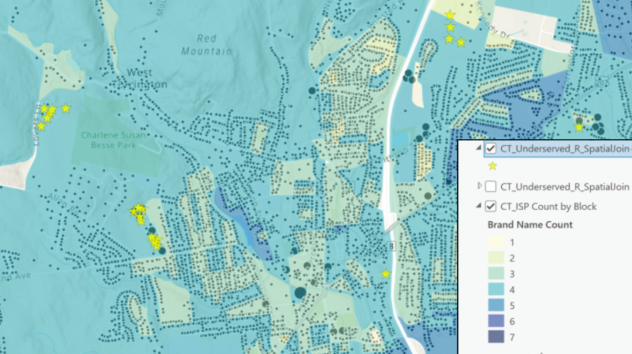
State BEAD Program Compliance
Developed comprehensive GIS strategy and visualization tools for a state broadband office, enabling streamlined FCC BDC compliance and informed $100M+ BEAD funding allocation.
 Feasibility Studies
Multi-Market Infrastructure Analysis
Conducted comparative analysis across 12 markets for regional telecom expansion, synthesizing constraints mapping, cost modeling, and regulatory compliance into strategic recommendations.
 Site Characterization
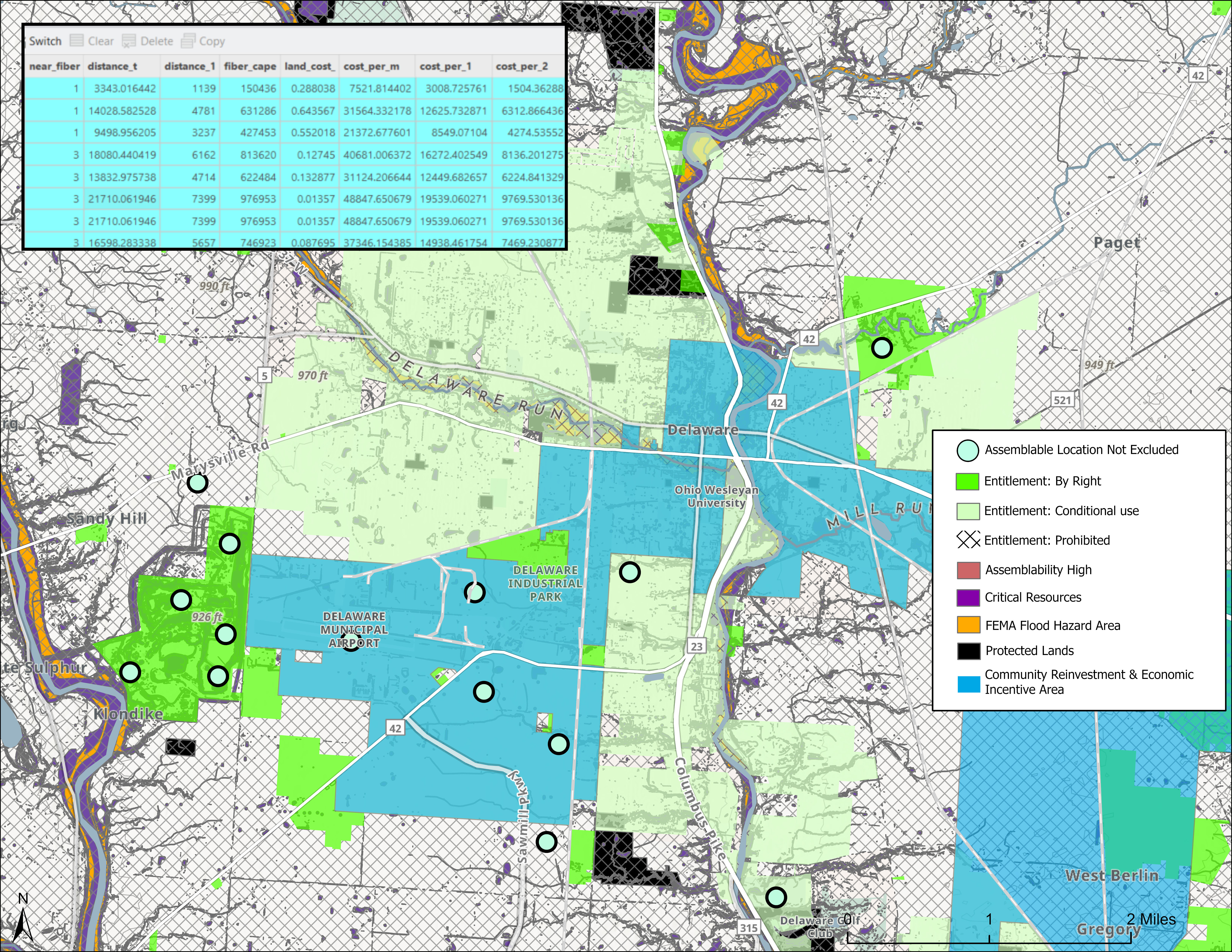
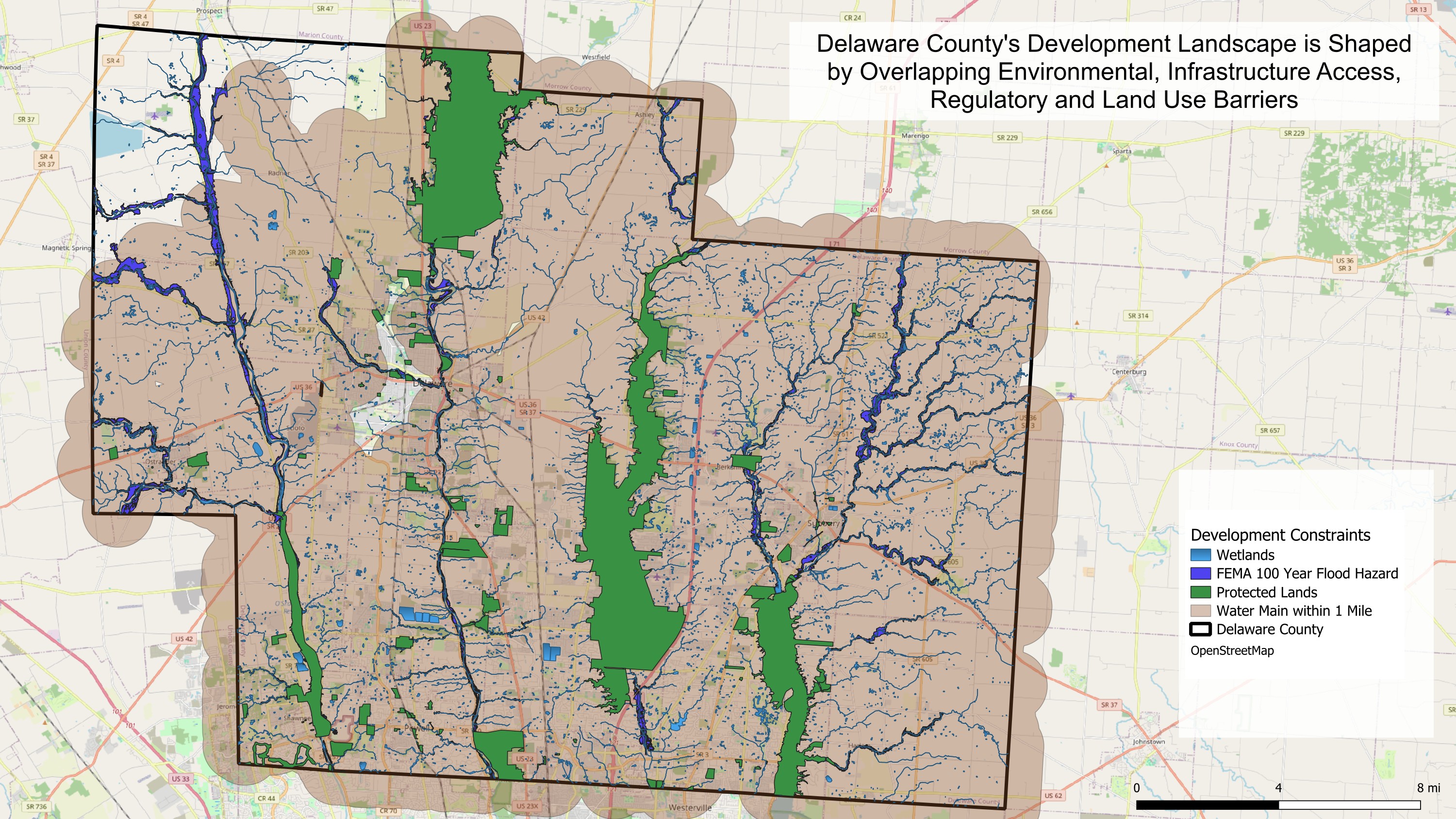
Real Estate Development Site Analysis
Performed multi-criteria site characterization for mixed-use development, integrating environmental constraints, utility access, and zoning analysis to identify optimal development parcels.
 Data Analytics
Automated Data Workflows
Developed Python automation scripts for project data ingestion and validation, reducing manual processing time by up to 80% and enabling real-time classification updates.